


Les Embiez
Cap Sicié

Rando Six-Fours
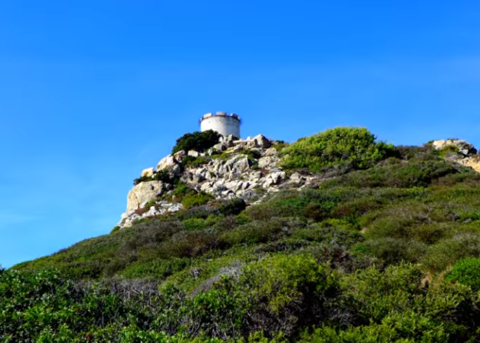
Notre Dame du Mai
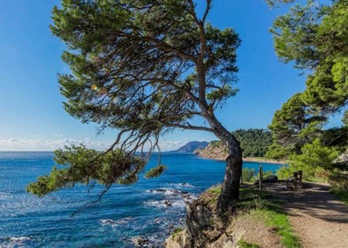
Sentier du littoral Saint Mandrier
... To keep fit ...
Running enthusiasts
Jogging by the sea (from the Bastide to Le Gaou)
Type of course: on the road by the sea
Approximate distance: 5 km round trip. Variation: for the more athletic, if you wish, instead of retracing your steps, you can go through the Chemin de la Gardiole, then the Chemin de la Lecques to take the Chemin de la Bastide. You will pass through the natural space of Mont Salva. The view is beautiful ! Add about 3 km to the base course, and a big climb for about 2.5 km. This route can also be done in reverse.
❤️ We like:do this race early in the morning to take advantage of the silence or at the end of the day when the light decreases every second and admire the sunset mid-way before making the return.
Good to know: When arriving at Gaou a self-service fitness machine (Airfit) in case you want to continue training while enjoying a breathtaking view!
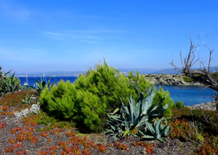
Massif of Cap Sicié
Type of route: on land, in the forest, by the sea ... 816 Ha of forest in the towns of La Seyne and Six Fours, whose summit culminates at 352m.
Approximate distance: dozens of routes ranging from 2km to 15km. They are detailed on the city map.
Elevation: low to steep depending on the route chosen.
Parking: Janas forest, Fabrégas, le Bœuf, Francillon, route du Mai or chemin de Notre Dame before the fire barrier.
❤️ We like: Being spoiled for choice! The preserved forest, the views overlooking the sea and all of our territory.
The Mediterranean Park
Type of course: on land, by the sea ...
Approximate distance: 1km of CRAPA sports course, possibility of completing the course in the Bois de la Coudoulière.
Parking: free on site.
❤️ We like:Have the leisure to enjoy the 7 hectares of this park, with sea spray and remarkable flora, in front of the sublime panorama of the bay of Six-Fours-Les-Plages and Sanary.
Hikers ...
Our Lady of May
Distance: 3 km.
Duration: 1 hour.
Positive elevation: 179 m.
Vertical drop: 125 m.
Difficulty: easy.
❤️ We like: Short walk to reach the summit of Notre-Dame du Mai facing the Mediterranean.One of the most beautiful 360 ° views of the Côte d'Azur! To do early in the morning or in the evening at sunset for the amber colors that the sun projects on the surrounding mountains or in the middle of the day in very good weather for the azure of the sky and the sea. Photos and unforgettable memories!
Fitness trail in the Janas forest
Distance: 9 km.
Duration: 3.15 hours.
Positive elevation: 280 m.
Vertical drop: 271 m.
Difficulty: easy.
❤️ We like: Invigorating half-day circuit to maintain your fitness in the Janas Forest with its 400 hectares and its many trails.Course mainly in the undergrowth and some cardio passages. Everything to please!
Central part of the Big Brain
Distance: 7 km.
Duration: 3 hours.
Positive elevation: 376 m.
Vertical drop: 383 m.
Difficulty: medium.
❤️ We like: The cutting of the Gros Cerveau massif in three hikes. The one in the center offers magnificent views of the bays of Bandol and Sanary but also up to Saint-Mandrier or Cassis. At the top, the Big Brain structure, made up of old abandoned military buildings.Towards the North, very nice views of Cadière d'Azur, Castelet, Evenos and even, in the background, the Sainte-Baume massif.
Le Faron
Distance: 12.5 km.
Duration: 4:45.
Positive elevation: 482 m.
Vertical drop: 467 m.
Difficulty: medium.
❤️ We like: One of the most beautiful hikes in the Var. This hike climbs Mount Faron by wide tracks and will offer you a breathtaking view of the most beautiful harbor in Europe.
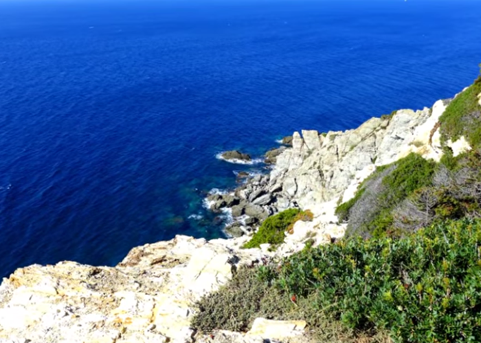
Cap Sicié ridge
Distance: 11 km.
Duration: 4 hours.
Positive elevation: 422 m.
Vertical drop: 428 m.
Difficulty: difficult.
❤️ We like: Very nice hike in balcony between sea and mountain towards Cap Sicié to arrive at Notre-Dame du Mai. 360 ° view. People prone to vertigo abstain…
Circuit de Janas by Notre-Dame du Mai
Distance: 15 km.
Duration: 6:30.
Positive elevation: 946 m.
Vertical drop: 945 m.
Difficulty: difficult.
❤️ We like: It is a route with varied landscapes: undergrowth, ridge, cliffs overlooking the sea, two peaks each of which offers a 360 ° view of the coast and the mountains. For the more courageous, a sporty and optional variant allows you to descend at the foot of Cap Sicié, to the sea.
Lovers of canoe, kayak or boat trips…
The Brusc, the rock of the Two Brothers by the sea
Distance: 19 km.
Duration:4:00 a.m.
Positive elevation: 18 m.
Vertical drop: 18 m.
Difficulty: medium.
❤️ We like: Kayak ride along the cliff between Le Brusc and Cap Sicié. Good training for the preparation of raids!
If you wish to take advantage of the region, before arriving at the Bastide, we strongly encourage you to prepare your activity well, namely to choose your hike well, consult the weather forecast, equip yourself accordingly and warn at least one person of your project. You will find all the information (description, map and advice) on the website ofVisorando .